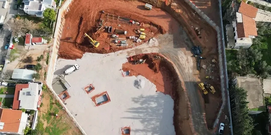
From the dense glacial till under downtown Des Moines to the shale bedrock near the Des Moines River valley, the subsurface conditions shift dramatically within a few city blocks. A deep excavation in the East Village encounters stiff, overconsolidated clays, while a cut-and-cover project near the airport deals with saturated alluvial sands that lose strength fast. These aren't just textbook contrasts; they're what the field crew documents every week across Des Moines projects. The city's 700,000 metro residents rely on infrastructure built into these formations, and getting the shoring design right starts long before the first bucket hits the ground. A solid test pit investigation logs the weathered zone up top, while SPT drilling quantifies bearing and settlement parameters at depth, giving the design team a continuous ground model across the variable geology of central Iowa.
Des Moines glacial till behaves like a brittle material once unloaded—the lateral stress relief during excavation can trigger block failures that don't appear in classical Rankine calculations.
How we work
What you notice after a few projects around Des Moines is how the groundwater table plays hide-and-seek with the excavation floor. In the western suburbs, perched water in weathered till shows up at 12 to 18 feet, then disappears entirely once you cut into the underlying shale. Downtown, the water table sits higher and tends to be hydraulically connected to the Des Moines and Raccoon Rivers, which means dewatering isn't optional; it's the primary load case. The design approach here leans heavily on observational method—install inclinometers and piezometers early, track lateral movement against predicted envelopes, and keep the
in-situ permeability testing results on hand because the actual infiltration rates rarely match the desktop estimate. For temporary support, soldier pile and lagging walls with tiebacks work well in the stiff glacial soils, but the shale zones demand rock mechanics input if the cut face stays open for more than a wet season. The team also runs
Atterberg limits on the clay layers because plasticity index swings from 12 to 35 across the metro, and that number changes the lateral earth pressure profile more than most engineers assume.
Local considerations
The Midwest freeze-thaw cycle doesn't get the attention it deserves in excavation design. Des Moines sees winter lows near -10°F and summer highs pushing 100°F, and that 110-degree annual swing works on exposed soil faces like a fatigue machine. Shale slakes when it freezes wet; till loses suction and softens during spring melt. A temporary cut that holds fine in October can start spalling by February, so the shoring design has to account for reduced soil strength after a couple of Iowa winters. Then there's the river proximity factor—sites within 500 yards of the Des Moines or Raccoon River during a wet spring face hydrostatic pressures that can overwhelm a base slab if the underdrain system isn't sized for the 100-year groundwater elevation. We've seen well-designed excavations stay dry for months, only to take on water during a May thunderstorm cycle that dumps three inches in 24 hours. The design has to assume the storm will arrive at the worst possible moment, because in Des Moines, it often does.
Questions and answers
What is the typical cost range for geotechnical design of a deep excavation in Des Moines?
How do you design for groundwater control during a Des Moines excavation?
Groundwater control design starts with in-situ permeability testing during the investigation phase. In the downtown area, where water levels are influenced by the Des Moines and Raccoon Rivers, we model the aquifer response seasonally and size a dewatering system—typically deep wells or wellpoints—to lower the phreatic surface at least 3 feet below the excavation floor. The design also includes a contingency for a 100-year precipitation event, which in central Iowa can deliver over 4 inches of rain in 24 hours.
What OSHA requirements apply to deep excavation design here?
All excavation designs in Des Moines must comply with OSHA 29 CFR 1926 Subpart P, which classifies excavations by depth and soil type. A registered professional engineer is required to design protective systems for excavations deeper than 20 feet, or for shallower cuts where adjacent structures or surcharge loads complicate the stability. The design submittal includes tabulated data and a site-specific plan signed and sealed per Iowa engineering board requirements.
How does the weathered shale layer affect excavation stability?
The Pennsylvanian shale beneath Des Moines weathers quickly when exposed to air and moisture. Within a few freeze-thaw cycles, a competent rock face can degrade into a weak, blocky mass with significantly reduced shear strength. The design accounts for this by specifying a shotcrete facing or a shorter exposure window, and by using rock mechanics parameters derived from point-load tests on core samples rather than published regional values.
Do you need to consider seismic loads for a temporary excavation support system?
In Des Moines, the IBC classifies most sites as Seismic Design Category C or D, with design spectral accelerations around 0.15 to 0.25g at short periods. While temporary shoring systems are sometimes exempt from full seismic design under IBC exceptions, if the excavation remains open through a construction cycle that spans a winter and spring, the design team typically runs a pseudo-static slope stability check using a horizontal coefficient of 0.5 times the peak ground acceleration. The additional anchor or bracing demand is usually modest but worth verifying.